Human remains
Except for several burials of children in Obre II (Benac 1973a, 72–82), human remains were unknown in the context of Butmir-sites. Hence, the discovery of human bones in the filling of one of the ditches in Okolište was exceedingly surprising. The first human remains of one individual were found in area 2 in layers of the youngest phase of the external ditch, dated to the period between 5000 and 4900 B.C. by radiocarbon analysis.
Also solely associated with the latest phase of the ditch-system, human remains were excavated in area 5 situated 15 m to the West. Within a distance of three meters two nearly complete skeletons were found lying in unusual positions (crouching and facing down) . In addition, a great number of disarticulated bones were scattered along the whole length of area 5, mixed with settlement rubbish like ceramics and animal bones.
The distribution over several excavation areas suggests that a longer section of the ditch once contained human remains. Unfortunately, this hypothesis was not confirmable in area 6 located a further 30 m to the West because due to differing geological circumstances the conditions for the preservation of bones were very poor there.
The anthropological investigations have shown that the human remains represent at least 14 individuals.
As far as determinable, the gender ratio is balanced and all age groups are represented; only subadult individuals are largely missing. Two of the highly fragmented skulls show perimortal fracture patterns as typically induced by blunt impact. However, these fractures could have also been inflicted after death.
Context and anthropological analyses of the found remains allow different interpretations. Their appearance only in the youngest ditch suggests that the bones were all deposited during a relatively short time span around 4900 BC. On the other hand, their different states of disarticulation, and the stratigraphic succession in which some of them were laid down makes it plausible that they were not buried or deposited in one single event.
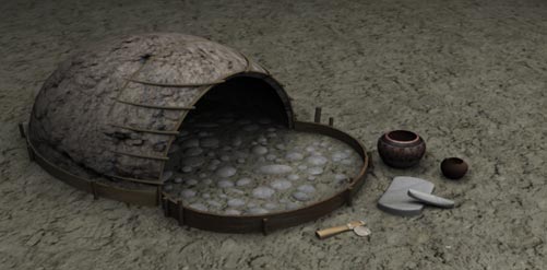 Oven 3d reconstruction
Find distributions
To understand the organisation of daily life and the degree of specialisation of the households within Okolište's community, the distribution of different categories of finds was analyzed (Hofmann et al. 2007, 131–143).
Within house 1 the distribution of fitting ceramic sherds and the functional classification of reconstructable vessels allows the identification of three activity areas: the northeastern room served for cooking, the central room for storage and the southwestern room for food consumption. Repeated occurrences of loom weights indicate that the northeastern parts of the houses were also used for weaving.
Contrary to that, the majority of stone tools was usually found in the alleys between the houses. In several areas large accumulations of silex flakes as well as cores were observed .The fact that the highest concentration of them was found within the southwestern part of house 6 can be explained by the use of the partly ruined house as a silex production area.
Summarizing the distributions of the several stone tool categories it is possible to distinguish areas for the production of flint tools on the one hand and areas for the use of other stone tools on the other hand, which were situated very close to each other.Specialisation of households in clearly delimited activity areas is not evident, though.
Considering this, the most likely explanations seem to be that these individuals fell victim to violent events, famine or epidemics; in contrast, the deposition of the remains as part of complex burial rituals appears rather unlikely.
Settlement structures
Within the enclosure the upper layers of three areas where excavated (Hofmann et al. 2007, 74–98). In the largest one, area 3 close to the centre of the settlement, the geomagnetic map shows three parallel structures directed northeast–southwest, measuring approximately 10 m each .
These structures turned out to be the remainder of three burnt down houses from the "classical Butmir" period . The rectangular, most eastern house is preserved best; the rubble revealed floors, hearths and inner subdivisions. Also in area 3, beside and underneath these burnt down houses, remains of further, unburnt houses were discovered .These remains in the form of horizontal, rectangular clay deposits had not appeared on the geomagnetic map. Both burnt and unburnt houses had been part of regular rows of parallel houses, exept for the older buildings 14 and 15.That burnt and unburnt houses existed side by side is to be explained by the fact that the same location was used for at least two generations of houses. The houses 8, 10 and 13 must have been already completely destroyed when the other, aforementioned houses burnt down; the remains of house 6, in contrast, were partially still standing and consequently were burnt as well.
Following these results, it can be deduced that the area was gradually abandoned, and that the density of buildings there once was much higher, higher even than the density the geomagnetic map suggest for the northeastern part of Okolište.For house 1 – the best-preserved among the three burnt ones – a ground plan could be reconstructed .It was probably divided into 3 rooms; with 4 by 10 m its dimensions conform to the general standard of the houses found in Okolište. Their construction resembles the houses found in Obre II (cp. Benac 1973a, 30–37), yet they tend to measure about 1m less in width, leading to only 30 sqm of floor space, compared to the average of 50 sqm found in Obre II.
In excavation areas 1 and 4, in the northeast of the site, similar regular building patterns were observed. However, the buildings from the upper layers here belong to the late Butmir period (Butmir III). This corresponds to the fact that anthropogenic remains have accumulated here for a longer period of time, thus raising the terrain by 0.5 m.Therefore, another substantial reduction of the settlement's size from 5.6 to 1.2 ha is assumed for the beginning of period Butmir III.
Furthermore, the excavations in area 4 have shown that here the building density is higher than was visible on the geomagnetic map. In general, a ratio between 1.2 : 1 and 1.4 : 1 of built to unbuilt space is deducible within the excavated areas which comes close to the maximum of the building density of settlement mounds in Southeast Europe
(Chapman 1989).